Home ] Up ] Area Overviews ] [ Trails ]

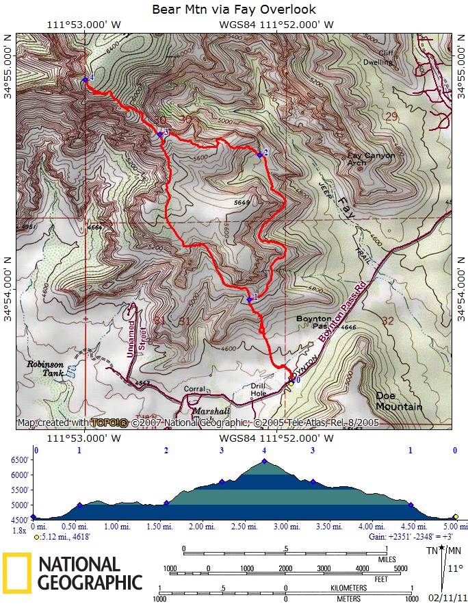
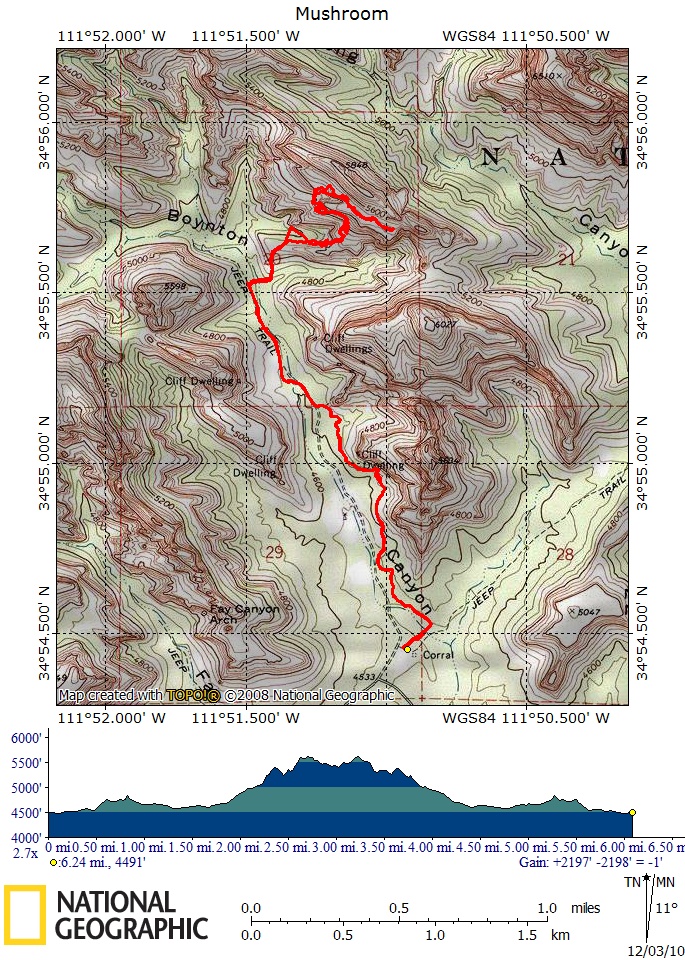
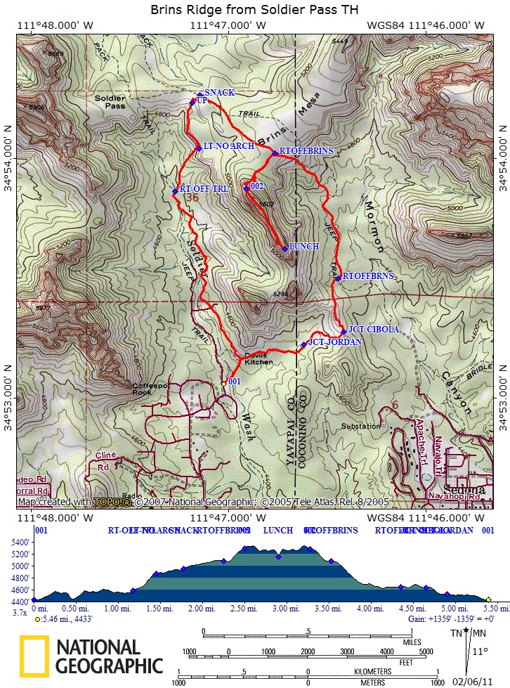
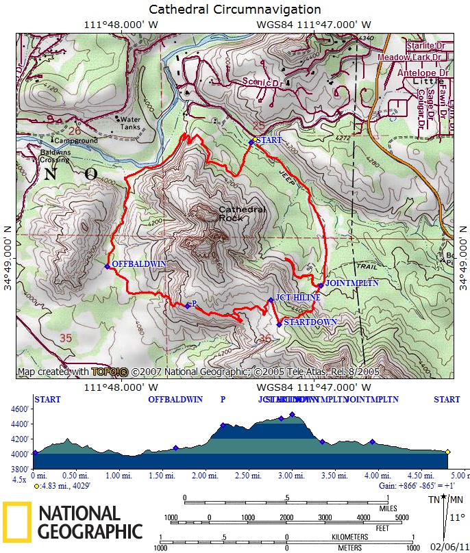
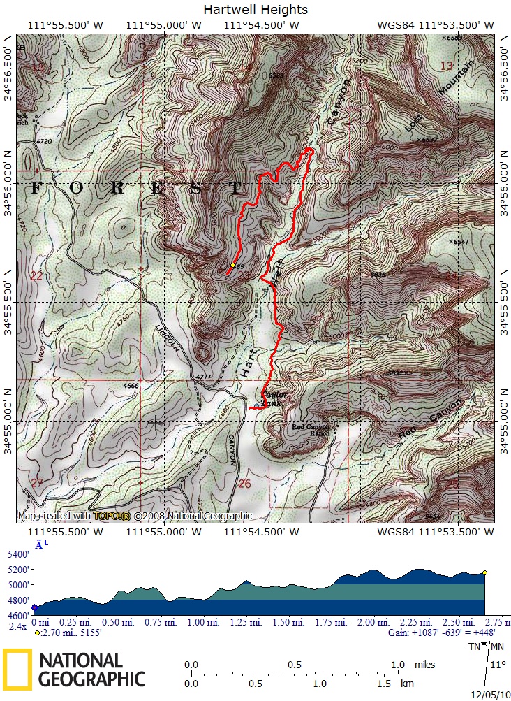
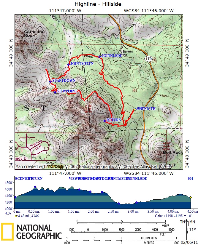
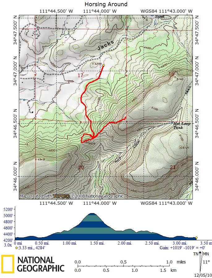
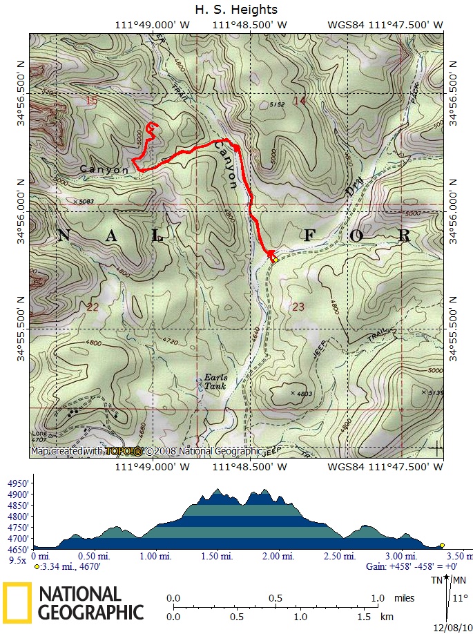
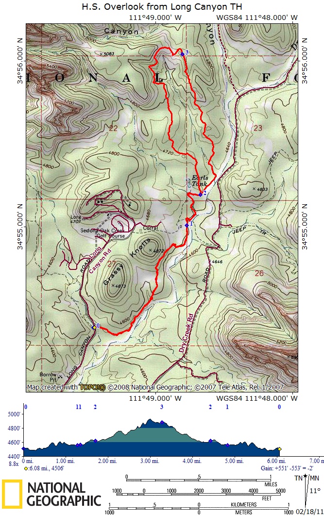
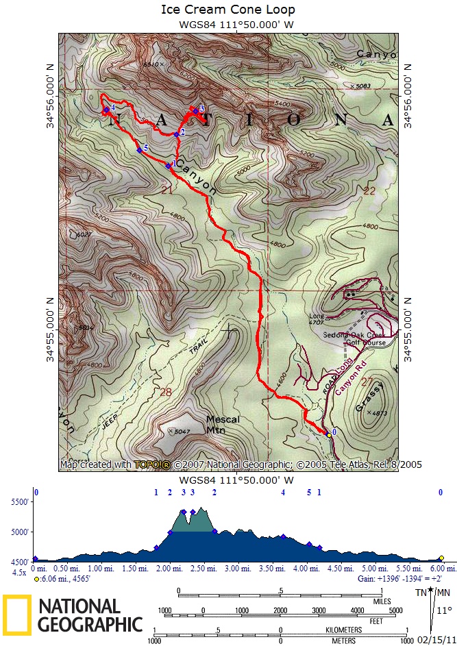
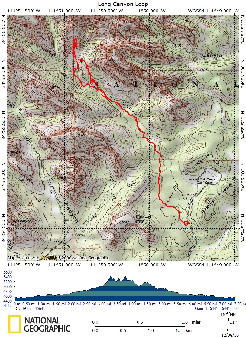
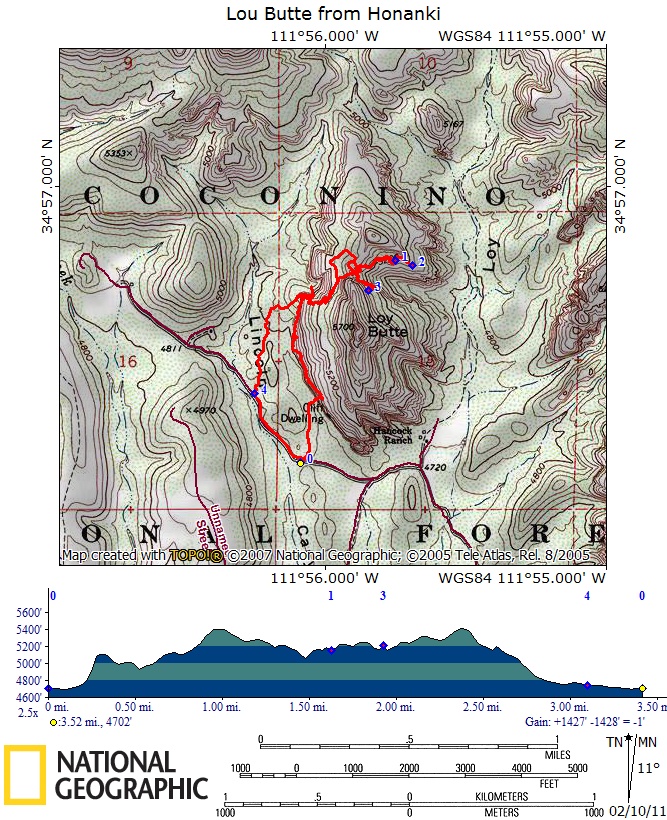
 The following table links to trail descriptions, maps, GPX files, and photographs.  As this project is in progress, some links will be missing, and descriptions need to be updated.  We have done our best to be accurate but there are doubtless errors and omissions; the data is meant for experienced hikers acquainted with the area and suitably attired and equipped.  GPS tracks at times amble off route before correction.  Let the hiker beware.  Along life's twisted paths, there are many missteps. 

We thank all our Sedona friends who have introduced us to its wonders.

To download GPX file, right click GPX and choose "Save link as . . . " 

Trail Description

Topo Map

GPX file

Pictures

Bear Mountain via Fay Canyon Overlook  2011 Map GPX Pictures
Bear Wallow 


  Pictures
Bell Mountain and Wet Beaver Creek  E


Boynton Mushroom  2011E

Map

GPX Pictures
Brins Ridge Loop from Soldier Pass TH 2011

Map

GPX Pictures
Cathedral Circumnavigation 2011

Map

GPX Pictures
Cibola Mitten Apache Tr Loop 

Map

GPX Pictures
Cockscomb  

Map

GPX Pictures
Doe Mountain      Pictures
Damfino Loop  2011

Map

GPX Pictures
Fay Canyon Overlook 2011

Map

GPX Pictures
Fay Canyon E

Map

GPX Pictures
Fin  

Map

GPX  
Gibraltar Saddle Loop from Chapel  2011

Map

GPX Pictures
Hangover  2011

 Map

GPX

Pictures
Hartwell Heights  2011E

Map

GPX Pictures
Highline-Hillside 2011

Map

GPX
Horsing Around  

Map

GPX  
H.S. Lollipop and Heights  

Map

GPX Pictures
H.S. Overlook from Long Cyn TH, Van Deren Cabin   2011

Map

GPX Pictures
Ice Cream Cone Loop  2011E Map GPX Pictures
Long Canyon Loop  E Map GPX Pictures
Loy Butte from Honanki   2011E Map GPX Pictures
Lost Wilson  

Map1  Map2

GPX1 Pictures
Many DucksTrail   Map GPX Pictures
Mescal Mountain 2011/nM Map GPX Pictures
Munds Mountain Overlook      Pictures
Mitten Ridge from Schnebly Rd   Map GPX Pictures
Narrow Canyon  2011E Map GPX Pictures
Robber's Roost      Pictures
Shadow Loop North  2011 Map GPX Pictures
Shadow Loop Middle  2011 Map GPX Pictures
Shadow Loop South   Map GPX Pictures
Scheurman Mtn  Map GPX  
Secret Arch       Pictures
Soldier Heights  2011E

  Map1 Map2

 GPX1 GPX2

Pictures
Steamboat  Map GPX Pictures
Surprise Canyon 2011E Map GPX Pictures
Sycamore Lollipop       Pictures
Sycamore Palisades      
The Windows 2011 Map GPX Pictures
Turkey Trot      Pictures
Vanderen Cabin from Dry Creek TH 2011 Map GPX Pictures
Wilson Canyon      Pictures
West Boynton Hoodoo  E Map GPX